The Locked Gate: A Logistics Roadmap for Eastern and Northeast India
How a 22-kilometre strip of land, three railway ministries, and seventy years of policy neglect conspired to keep India's east from industrialising - and what an aligned centre-state government could actually do about it.
0 of 7 sections read
Somewhere in Vadodara, a purchasing manager at a specialty chemicals company is preparing a shipment. The buyer is Tata Semiconductor Assembly and Test (TSAT) in Jagiroad, Assam - India’s first indigenous greenfield semiconductor assembly and test facility, built at a cost of ₹27,000 crore on the site of the old Nagaon Paper Mill. The shipment contains substrate materials and packaging chemicals that TSAT needs to receive reliably, on schedule, to keep its lines running. Finished chips - for automotive ECUs, EV systems, telecom hardware - have to ship out to OEMs at regular cadence. Any disruption in the inbound materials chain cascades into production delays.
The freight leaves Vadodara. It joins the Western Dedicated Freight Corridor at Jawaharlal Nehru Port terminal, moves east across the Gangetic plain at speeds that would have seemed impossible on the old network, and arrives at Dankuni in West Bengal. And then it stops.
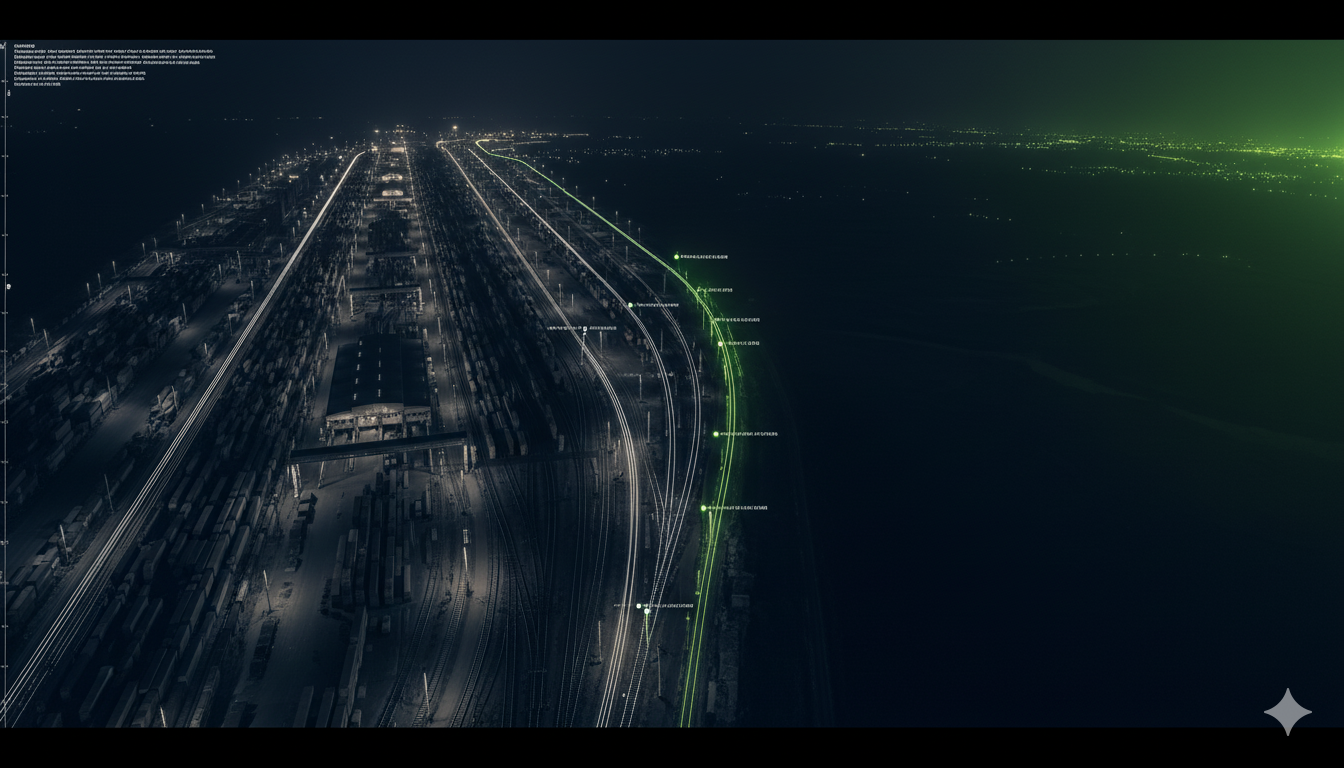
At Dankuni, the Eastern Dedicated Freight Corridor ends. There is no sanctioned extension northward. The materials re-enter the conventional railway network, join a queue of coal rakes, passenger trains, and other freight on tracks that were designed for a different era, and must pass through a stretch of land roughly 22 kilometres wide at its narrowest. Locals in northern West Bengal have a name for this stretch. So does the Indian Army.
The Chicken’s Neck.
At the Siliguri Corridor - the only land connection between the northeastern states and the rest of India - all road traffic, all rail freight, all pipelines, and all electrical cables serving eight states and 45 million people must pass. Nepal lies to the north. Bangladesh to the south. Through this geological accident of post-Partition cartography, the TSAT materials will travel at perhaps 30 km/h, stopping and starting, possibly waiting while a landslide team clears the track ahead, before continuing another 250 kilometres to Jagiroad.
That disruption is not theoretical. The Lumding-Silchar rail line in Assam, which serves southern Assam and Mizoram, was cut by landslides in the Dima Hasao district at least four times in the past decade. A 2022 breakdown isolated the Barak Valley for weeks. A semiconductor assembly plant cannot absorb that kind of supply chain variance.
The Siliguri Corridor is not the only problem. It is simply the most dramatic symbol of a deeper truth: Eastern and Northeast India has been navigating its economy around a geography that was never meant to be a constraint. Before 1947, Bengal was a single, continuous province. Goods moved freely from Dhaka to Calcutta, from Sylhet to Shillong. The partition of British India created East Pakistan - now Bangladesh - and in doing so, severed the Northeast from the mainland, leaving it connected by a narrow thread of land that had previously been unremarkable tea garden country.
Seventy-eight years later, the scar is still there. Assam, a state with the Brahmaputra running through its heart, a land corridor touching five international borders, and a soil rich enough to produce some of the world’s finest tea, exports goods worth roughly ₹3,700 crore a year. Tea accounts for more than half of that. The second largest export item tells you something about value addition in the region: crude petroleum, sold largely unprocessed.
West Bengal, meanwhile, sits at the opposite end of this corridor with a port city that was once the commercial capital of the British Empire. The Kolkata Port - now renamed Syama Prasad Mookerjee Port - handles roughly 60% of its theoretical capacity. Its approach channel on the Hooghly is constrained by silt to a maximum draft of 7.5 to 8 metres, restricting access to smaller vessels under 12,000 deadweight tonnes. Modern container ships draft twice that. The port’s average vessel turnaround time runs to 3.5 days. Singapore’s benchmark is 12 hours.
These are not problems without solutions. They are problems without political will - or more precisely, problems that have required a specific political alignment to address. That alignment now exists.
The question this report attempts to answer is not whether the logistics of Eastern and Northeast India can be fixed. The answer is yes. The question is what the fixes actually look like, what they cost, what sequence they need to follow, and what they unlock when they work.
FIGURE 1: THE LOGISTICS BURDEN GRADIENT
Relative logistics cost burden by region, indexed to national average. Northeast-bound cargo carries the highest logistics costs in India (DPIIT-NCAER, FY24).
The Sources Behind This Report
This report draws on a body of government and institutional research that has, in aggregate, produced more paper than infrastructure.
The DPIIT-NCAER Logistics Cost Assessment (2025) is the first rigorous, primary-survey-backed estimate of India’s logistics costs, covering 500+ industry users and 3,000+ service providers. It formally establishes that Northeast-bound cargo carries the highest cost burden in the country.
The LEADS 2024 Report (6th edition, Ministry of Commerce and Industry, January 2025) is the government’s own scorecard of logistics performance across all states. Assam is now in the “Achievers” category - a meaningful shift from a low base. West Bengal trails on port utilisation.
The West Bengal Logistics Policy 2023 is candid about the state’s problems in ways its authors possibly did not intend, acknowledging “high freight cost, fragmented infrastructure, limited connectivity” even as it positions West Bengal as a logistics hub.
A Research and Information System for Developing Countries (RIS) policy brief from April 2026 is the most unflinching recent assessment of why India’s Act East gateway rhetoric has not materialised. Its central finding: multiple agencies operating in silos have collectively produced incoherence.
The DFCCIL documentation confirms what the maps already show: the Eastern Dedicated Freight Corridor runs 1,856 kilometres from Ludhiana to Dankuni and stops, completely, at Dankuni. No extension into the Northeast has been sanctioned.
The Jogighopa MMLP project documentation covers India’s first international multimodal logistics park, nearing completion on 317 acres on the Brahmaputra’s south bank.
The February 2026 underground railway announcement - Railway Minister Vaishnaw’s proposal for underground tracks through the Siliguri Corridor - is a recognition that the Chicken’s Neck has moved from logistical inconvenience to acknowledged strategic vulnerability.
These are not obscure sources. They are the government’s own assessments of its own infrastructure. The diagnosis is not contested. What has been missing is a synthesis that connects them to a concrete industrial strategy.
In December 2025, the Network Planning Group - a body under DPIIT that reviews infrastructure proposals under PM GatiShakti - held its 104th meeting. It reviewed eight railway projects. One was the Santragachi-Panskura-Kharagpur fourth line in West Bengal, a proposal to add capacity to a passenger-freight corridor already described as “heavily congested.” Another was the Barbenda-Damrughutu-Bokaro freight corridor, serving the Bokaro Steel Plant and Tata Steel supply chains.
The NPG review was orderly. The documentation was thorough. The proposals were assessed.
And then, presumably, they joined the queue.
This is not a criticism of the NPG. The NPG is doing precisely what it was designed to do. The problem is structural: India has created a sophisticated architecture for reviewing infrastructure proposals, but the architecture for building them is something else entirely. The Ministry of Railways, MoRTH, the Ministry of Ports Shipping and Waterways, DoNER, the Ministry of Commerce, NITI Aayog, and the relevant state governments all have overlapping mandates, separate budget heads, and institutional incentives that do not necessarily align.
The RIS brief of April 2026 is blunt. It describes multiple agencies operating “in silos, diluting policy coherence.” The critique is aimed at Act East Policy implementation, but it applies with equal force to domestic infrastructure. The ministry that controls rivers is not the ministry that controls rails is not the ministry that controls highways is not the state government that controls land.
Consider what it takes to build something as apparently simple as a rail link from the Jogighopa MMLP to the Brahmaputra river port being developed by the Inland Waterways Authority. The MMLP is being built by NHIDCL, which sits under MoRTH. The river port is under IWAI, which is under MoPSW. The rail siding connects to Northeast Frontier Railway, under the Ministry of Railways. The land the siding crosses belongs to the state government of Assam. Each entity has its own procurement processes, its own timelines, and its own interpretation of what “coordination” means.
FIGURE 2: THE GOVERNANCE SILO MAP
Key ministries and agencies with overlapping mandates in Eastern/NE India logistics. Each node represents a distinct budget head, procurement process, and accountability structure.
On February 2, 2026, Railway Minister Ashwini Vaishnaw made an announcement that would have been unthinkable a decade earlier. He revealed plans to build underground railway tracks through the Siliguri Corridor: not just underground, but a quadrupling of the existing surface lines, a strategic hardening of the Chicken’s Neck against natural disasters and external threats. The underground stretch would run between Tin Mile Haat and Rangapani stations, roughly 40 kilometres.
It was a striking statement of intent. It was also not yet accompanied by a feasibility study timeline, a cost estimate, or a land acquisition schedule.
The announcement matters not for what it confirms - that the government recognises the Siliguri Corridor as India’s most acute logistics vulnerability - but for what it implicitly acknowledges about the seventy years before it. For most of post-independence India’s history, the solution to the Chicken’s Neck was not to fix the Chicken’s Neck. It was to route everything through it anyway and hope nothing broke.
The Rail Gap
The Eastern Dedicated Freight Corridor is one of India’s genuine infrastructure achievements. Completed in full by early 2024, it runs 1,856 kilometres from Ludhiana in Punjab to Dankuni in West Bengal. It moves freight at 75-99 km/h, against 20-25 km/h on conventional tracks. It handles 352 trains per day and rising. It has measurably lowered logistics costs on the Gangetic plain.
And it stops at Dankuni.
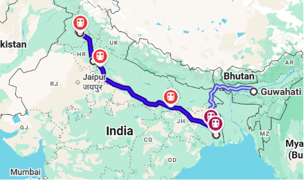
FIGURE 3: THE EASTERN DFC ROUTE AND THE NE GAP
The Eastern Dedicated Freight Corridor runs 1,856 kilometres from Ludhiana (Punjab) through Jaipur, Kanpur, and Dankuni (West Bengal), completing its final section in early 2024. From Dankuni, freight destined for the Northeast reverts to the conventional rail network, passing through the Siliguri Corridor – the only 22-kilometre-wide land link connecting eight northeastern states to mainland India. No EDFC extension beyond Dankuni has been sanctioned.
There is a standing proposal to extend it. The DPR for a Dankuni-Jalpaiguri-Assam spur has been gestating since 2016. It has been “under consideration” - a phrase in Indian infrastructure that means it is, more or less, dead. The economics are sound. A dedicated rail corridor from Dankuni to the MMLP at Jogighopa would cut the transit time from a week to 48 hours. It would move semiconductor substrates, cold-chain perishables, and outbound finished goods at freight rates that compete with trucking without the time penalty. The corridor would generate enough freight volume within five years to cover the cost of capital.
But it requires capital allocation in a railway budget that is already strained. It requires land acquisition across three states. It requires DFCCIL and Northeast Frontier Railway to find a coordination mechanism that has eluded them for a decade.
These are not technical problems. They are political and administrative problems.
At Dankuni, then, the freight situation bottlenecks into three directions. It can proceed north on the conventional network - slow, unreliable, expensive. It can be trucked, which is faster but also expensive and weather-dependent. Or it can switch to the water route.
The Water Gap
The Brahmaputra runs through the heart of Assam. The National Waterway 2 (NW2) connects Upper Assam - the Dibrugarh-Lakhimpur region, where much of India’s tea and oil production originates - all the way to Haldia. At capacity, NW2 could move 50 million tonnes per year. Today it moves roughly 2 million.
The gap is not technical. It is logistics and institutional.
A barge from Dibrugarh to Haldia takes 10-12 days in monsoon, 18-25 days in lean season. Tidal variation at Haldia makes the approach channel unpredictable. The Haldia channel deepening project under Sagarmala is designed to address this, but its completion timeline has slipped from 2023 to 2025, and even then, approach channels are only half the story. You need container handling infrastructure. You need scheduled services, not occasional barge movement.
The Jogighopa MMLP is designed to change this. The project documentation specifies 317 acres of multimodal terminal - road, rail, and waterway connections on the Brahmaputra. A Special Purpose Vehicle will handle customs clearance, hazmat management, and container logistics. But the SPV is not yet formed, and the MMLP is not yet operational. It is a project that has been “almost complete” for three years.
The Road Problem
The National Highways in the Northeast are, in principle, the arterial supply routes. NH27, NH31, NH37, and NH44 all touch the region. In practice, they are unreliable.
NH31 from Assam to West Bengal passes through hilly terrain prone to landslides. In the monsoon season, sections close for days at a time. A truck consignment that can take 48 hours on a good day stretches to 96 hours or more when a slide closes the road. For perishable goods - fruits, fish, cut flowers, packaged ready-to-eat - this is not a minor inconvenience. It is a loss.
The Assam Strategic Road Development Program has been upgrading these routes. The Guwahati-Jogighopa stretch of NH37 is being widened to a 4-lane expressway. But upgrades take time, and until they are complete, the road network cannot be the backbone of Northeast logistics.
In a field near Jagiroad in Morigaon district, Assam, construction crews are finishing what will become India’s largest semiconductor assembly and test facility outside Karnataka. Tata Semiconductor Assembly and Test (TSAT) is an Outsourced Semiconductor Assembly and Test (OSAT) facility: it receives silicon wafers from fabrication plants, assembles them into packaged chips using wire bond, flip chip, and Integrated System in Package technologies, and ships finished semiconductors to automotive, EV, telecom, and consumer electronics OEMs in India and globally.
The investment is ₹27,000 crore. Production capacity when fully operational: 48 million packaged chips per day.
The choice of Assam for this facility was not obvious. For thirty years, the conventional wisdom in Indian manufacturing was that electronics required a southern or western cluster - Sriperumbudur in Tamil Nadu, the Bhiwandi-Pune corridor in Maharashtra. The logic was the same as the Chicken’s Neck logic: the south had ports, established supply chains, and dependable road-rail connectivity.
What changed the calculus for Tata was a combination of land availability (large, flat, contiguous parcels in the Brahmaputra valley, including the site of the defunct Nagaon Paper Mill), incentive density under NEIDS, the proximity to semiconductor packaging hubs in Taiwan, Malaysia, Vietnam, and Singapore, and an engineering talent pool drawn from across the Northeast. What also changed was the geopolitical logic: as China-plus-one supply chain strategies accelerate, a semiconductor node on India’s eastern flank, relatively proximate to Asian packaging supply chains, has long-term value that purely domestic logistics analysis misses.
But the TSAT facility is now a stress test. Its economics depend on logistics running in both directions. Inbound: packaging substrates, chemicals, and test equipment consumables arrive from suppliers in Gujarat, Tamil Nadu, and via air freight from Taiwan and Malaysia. Silicon wafers come in by air from foundry partners. Finished chips go out to automotive OEMs (Maruti, Tata Motors, Mahindra, and export customers) via road, rail, and air. The inbound ground-freight problem is particularly acute: specialty chemicals and substrates are heavy, regular, and sensitive to supply chain disruption. A week-long delay in packaging substrate delivery stops a production line that costs thousands of crores to build.
Air freight absorbs the time-sensitivity for the highest-value inputs. But this is expensive, and scaling a semiconductor manufacturing cluster from one facility to ten requires that ground logistics eventually becomes reliable enough to carry the volume. The 4-lane expressway being built on the Jogighopa-Guwahati stretch, the MMLP’s bonded warehouse and customs clearance infrastructure, the connection from Dankuni onward through the Siliguri Corridor - each of these reduces the cost of operating the plant. Together, they determine whether the TSAT facility remains a standalone anchor or becomes the first node in an eastern semiconductor corridor.
The NEIDS Transport Subsidy: A Critical Bridge
The Northeast Industrial Development Scheme (NEIDS) includes a transport subsidy of up to 20% on eligible manufactured goods moved by rail, and up to 33% on goods moved by air. This is a direct Central government response to the logistics cost premium - essentially, the state is paying part of the freight bill to make NE manufacturing competitive. The subsidy works as long as manufacturing activity is there to subsidise. For OSAT-type semiconductor operations, where per-unit transport cost as a fraction of chip value is manageable, the subsidy is probably sufficient for the initial phase. For agri-processing, where margins are thinner, the calculus is tighter.
The Agri-Processing Opportunity
If electronics in Assam is a story about attracting anchor investment from outside, agri-processing is a story about what Assam and the Northeast already have in abundance - and how little of it they are capturing in value.
The Northeast produces more than 40% of India’s horticultural output. Assam alone produces tea, turmeric, ginger, bamboo, and a range of tropical fruits for which there is significant international demand. West Bengal grows jute, spices, and fruit. Manipur and Mizoram produce ginger, turmeric, and citrus. Meghalaya produces betel nuts and oranges. Tripura produces rubber, spices, and vegetables.
Yet, the Northeast accounts for less than 8% of India’s agri-processing output. Raw materials are shipped to processors in Gujarat, Karnataka, or Tamil Nadu. Value is added there. Branded products are shipped back or exported from ports in the west or south. The Northeast is a raw material exporter, even though it has the soil, the climate, and the labour to process at scale.
FIGURE 4: INDICATIVE LOGISTICS COST BREAKDOWN: GUWAHATI TO EXPORT PORT
Indicative cost components for a manufactured goods consignment from Guwahati to Kolkata Port for export. Based on industry estimates and DPIIT-NCAER FY24 findings.
The pattern is consistent: abundant natural resource, minimal processing infrastructure, high logistics barriers to getting processed goods to market. The result is that the Northeast functions as a raw material exporter to the rest of India - precisely the condition that every NE policy document since 1972 has identified as the problem and proposed to solve.
The agri-processing case is also the cold chain case. The Jogighopa MMLP specification includes cold storage. What the Northeast needs is not one cold storage facility at one MMLP - it needs a network of cold chain nodes connected to the logistics backbone, the same way that the tea processing ecosystem has drying and sorting infrastructure distributed across tea garden districts.
FIGURE 5: NE INDIA VALUE-ADDITION GAP: KEY AGRI-PROCESSING SECTORS
Estimated % of agri output that is processed in-region before leaving NE India. Tea’s high score reflects 150 years of ecosystem investment. Everything else shows what happens without it.
A roadmap that says “fix the Chicken’s Neck, upgrade Kolkata Port, build cold chains, and coordinate the ministries” is not a roadmap. It is a wish list. What follows is a sequenced strategy that attempts to be specific about what needs to happen first, what can happen in parallel, and what unlocks later phases.
The sequencing logic is simple: remove the single-point-of-failure first, then build the multimodal network behind it, then attract the industrial investment that justifies the network.
Phase 1: The Corridor Hardening (2026-2028)
The Siliguri Corridor underground railway proposal is on the table. The government has announced intent. The gap is implementation architecture: a feasibility study, a DPR for the underground alignment, and a committed budget allocation that does not get reabsorbed into the annual railway capital programme.
The surface quadrupling can proceed in parallel with the underground DPR and will complete faster. The Tin Mile Haat to Rangapani alignment is identified. What is needed is a single entity - DFCCIL or a dedicated SPV - with ownership of the corridor-hardening project, so it does not get lost between Ministry of Railways and state government approvals.
Simultaneously: the Dankuni node. The EDFC terminates at Dankuni but the terminal infrastructure for onward rail connections northward needs upgrading. A dedicated Dankuni-Jalpaiguri freight slot arrangement - using the conventional network with priority freight timings - would improve Dankuni-to-Northeast transit time without new track construction. This is achievable through scheduling and track-sharing agreements between DFCCIL and Northeast Frontier Railway.
Phase 2: The Multimodal Build-Out (2027-2031)
The Jogighopa MMLP needs to become operational. The engineering is largely in place. What has been consistently delayed is the governance structure - the Special Purpose Vehicle that will manage operations, handle customs clearance, and coordinate road-rail-waterway connections. This is an administrative deliverable, not an engineering one, and is completable within twelve months of political will being applied.
The Brahmaputra inland waterway needs scheduled commercial services (not occasional movement), standardised container handling at Jogighopa and IWT terminals, and maintained dredging for approach channels. IWAI has the mandate. It needs the budget allocation and the guaranteed freight volumes that come from having anchor tenants. This is the chicken-and-egg problem at the heart of NE logistics: infrastructure needs anchor demand to be commercially viable, but anchor demand does not materialise until infrastructure is reliable. The way to break this loop is a Central government freight guarantee - a committed tonnage backstop for the first three years of Brahmaputra IWT commercial operations - that allows IWAI and private operators to schedule services before private freight volume is proven.
The Kolkata/Haldia side involves: (a) completing the Haldia channel deepening under Sagarmala to allow larger vessels, (b) building out container terminal capacity at Haldia beyond the newly commissioned APSEZ bulk terminal, and (c) improving the Dankuni-to-Haldia freight corridor, which currently lacks dedicated freight slots. The APSEZ Haldia Bulk Terminal - fully automated, direct rail evacuation, 4 MMTPA - is the operational template. The question is whether this model extends to container handling at sufficient scale.
Phase 3: Industrial Anchor Attraction (2029-2035)
By 2029, if Phase 1 and 2 execute on schedule, the logistics profile of the Assam-West Bengal corridor looks materially different:
A hardened Siliguri Corridor with quadrupled surface lines and an underground rail option in construction. A functioning Jogighopa MMLP with multimodal connectivity, cold storage, and live customs clearance. Brahmaputra IWT with scheduled commercial services. Haldia with improved draft clearance and container handling capacity. A Dankuni-Jalpaiguri freight priority corridor connecting to the EDFC.
In this environment, the case for electronics manufacturing investment in the Assam corridor strengthens considerably. TSAT Jagiroad is an anchor. The incentive architecture of NEIDS, combined with logistics reliable enough for regular supply chain commitments, creates conditions for a second and third OSAT or electronics manufacturing anchor. The component-maker ecosystem that clusters around a dominant assembler - the pattern visible around Sriperumbudur in Tamil Nadu - can begin to form at Jagiroad and along the Guwahati industrial belt.
For agri-processing, Phase 3 involves purpose-built processing zones: not generic industrial parks, but facilities co-located with cold chain infrastructure, testing labs for GI product certification, and dedicated freight access for perishable goods. The Brahmaputra valley has the feedstock. Assam’s horticultural exports need the same infrastructure treatment that tea has had for 150 years - a distributed, specialised processing and export ecosystem that captures value before the raw material leaves the state.
FIGURE 6: PHASED ROADMAP TIMELINE
Sequenced delivery milestones across three phases. Phases overlap. Phase 3 industrial investment follows logistics reliability signals, not calendar dates.
The West Bengal Piece
West Bengal is not a secondary player. It is the logistics gateway through which virtually all of the Northeast’s external trade passes, whether by rail, road, or sea. The West Bengal Logistics Policy 2023 is a credible document that identifies the right problems. The gap is implementation.
Under a cooperative Centre-state configuration, the specific asks from West Bengal are: land clearance for the Dankuni freight terminal expansion (WBIDC has existing land allocation frameworks); clearing right-of-way for the fourth line on the Santragachi-Kharagpur corridor; supporting Haldia channel deepening by expediting coastal regulation clearances that are within state jurisdiction; and integrating the Amritsar-Kolkata Industrial Corridor (AKIC) planning with the EDFC terminus at Dankuni.
The AKIC is particularly important. It runs alongside the EDFC and is meant to develop industrial zones every 150 kilometres or so along its length. West Bengal’s section - the Durgapur-to-Dankuni belt - is one of the most industrially established strips in eastern India. Connecting it properly to the EDFC and to the onward NE corridor would give it a logistics profile comparable to the Delhi-Mumbai Industrial Corridor.
The problem is not that India cannot build these things. India has built the EDFC. India has built ports. India has brought semiconductor manufacturing back onshore. The problem is not technical incapacity.
The problem is coordination at scale. The Siliguri Corridor hardening, the MMLP operationalisation, the IWT freight guarantee, the port expansions at Haldia, and the industrial anchor attraction all require a governance structure that aligns incentives across multiple ministries, multiple states, multiple timelines, and multiple budget heads.
This kind of alignment is not natural. It does not happen because a policy document says it should. It happens because someone has political ownership of the outcome, and enough authority to make trade-offs between competing claims.
The emergence of a unified political configuration - with the same party holding office at the Centre, in Assam, and in West Bengal - creates the conditions for this ownership to exist. The specific person who holds this ownership matters less than the fact that one person has the power to say: “This is the priority. This is the sequence. This is the accountability structure. This gets done.”
Without this, proposals like the Dankuni-Jalpaiguri freight corridor die in committees. The MMLP sits half-finished for another three years. The Brahmaputra remains a wasted asset. The Siliguri Corridor undergoes cosmetic upgrades that do nothing to address the underlying constraint.
With it, the outcome is not guaranteed - but it becomes possible. What was gestating for a decade can move in two years. What required individual ministry approval can be resolved through a single ownership structure. Coordination becomes a matter of hierarchy, not consensus.
The Implementation Window
The government has explicitly signalled that East India logistics is a priority. The Underground Railway announcement, the MMLP emphasis, the channel deepening project, the ongoing EDFC optimization - these are not marginal initiatives. They are central to “Act East” strategy and the “Viksit Bharat 2047” articulation of long-term manufacturing ambition.
The Centre-state alignment makes this ownership possible. The opposition that will inevitably come - from competing infrastructure projects, from bureaucratic inertia, from state-level parochialism - is surmountable if the ownership structure is clear.
The window is two to three years. Within this window, Phase 1 execution must demonstrate enough progress that Phase 2 becomes self-sustaining through private investment. Jogighopa MMLP must be operational. Dankuni-Jalpaiguri freight slots must be active. The Siliguri Corridor DPR must be complete and funded. The underground alignment must move from announcement to engineering.
If this happens on schedule, Phase 2 and 3 follow as a matter of course. If it slips by even a year, political attention will move elsewhere, and the window closes.
This is not pessimism. This is the nature of infrastructure coordination in India. The technical solutions are known. The political alignment exists. What is uncertain is whether the governance structures that India has built - the NPG, the state governments, the ministries - will move with sufficient speed to capture this moment.
The Locked Gate can be unlocked. The machinery exists. What remains is the decision to use it.
FIGURE 7: LOGISTICS COST REDUCTION POTENTIAL: SCENARIO ANALYSIS
Indicative logistics cost as % of product value under three scenarios. Electronics and agri-processing shown separately. Agri-processing carries a larger cold-chain gap premium that Phase 2 cold chain investment specifically addresses.
Bibliography and Key Sources
- DPIIT-NCAER Logistics Cost Assessment for India, FY 2023-24 (October 2025). First primary-survey-based national logistics cost estimate.
- LEADS 2024 Report: Logistics Ease Across Different States (Ministry of Commerce and Industry, January 2025, 6th edition).
- West Bengal Logistics Policy 2023 (DPIIT portal).
- DFCCIL: Eastern DFC route documentation and Ministry of Railways PIB updates through February 2025.
- Jogighopa MMLP - PIB ministerial review (multiple updates, 2022-2024).
- RIS: “Act East, Lagging Northeast” policy brief (April 2026).
- NITI Aayog: “Goods on the Move: Efficiency and Sustainability in Indian Logistics” (2023).
- IBEF: Northeast India as logistics gateway to Southeast Asia (March 2024).
- Underground Railway announcement, Siliguri Corridor (February 2026).
- APSEZ Haldia Bulk Terminal commissioning (March 2026).
- TSAT Jagiroad - Tata Group announcement (February 2024) and Wikipedia summary.
- India Logistics Market: PIB overview (August 2025).
- NE highway construction: DD News 11-year review (2024).
Don't miss policy updates
Get the latest intelligence on industrial schemes, subsidy disbursements, and policy shifts across Northeast India, delivered to your inbox.